Pilbara, WA
|
|
Time to read 3 min
|
|
Time to read 3 min
While the Pilbara is generally dry and arid, water flows year round in Millstream. The Millstream wetlands are fed by a natural underground reserve contained in the porous dolomite rock, which itself is fed by runoff from the Hamersley Ranges. It is believed to store 1700 million cubic metres of water - making the area a haven for plants and animals.
Stock up on supplies and fuel in Karratha before heading down the Karratha/Wittenoom Road. It provides safe passage through the steep terrain of the Chichester Ranges, and is sealed to Barowanna Hill. The road runs parallel to the Pilbara Railway that transports iron ore from Tom Price and Newman to Karratha Port for export. Occasionally the locomotives run past, weaving their way through the mountains with an endless trail of carriages in pursuit. Alternative access is available from the north via the Roebourne/Wittenoom Road or the west via Millstream/Pannawonica Road.
Set up camp under a Millstream Palm at the delightful Crossing Pool Campground on the banks of the Fortescue River in the park's southwest. The camp used to be much bigger but with regular flooding was lost to the river. These days it is limited to about eight vehicles in undefined campsites under mature tree cover. It's a lovely peaceful spot with a gas barbecue, pit toilets and communal picnic table on a grassed plot. There are excellent bird watching opportunities and the river is suitable for swimming, paddle craft or fishing. Embankment ladders at all of the main swimming holes prevent injury from entering via the slippery banks.
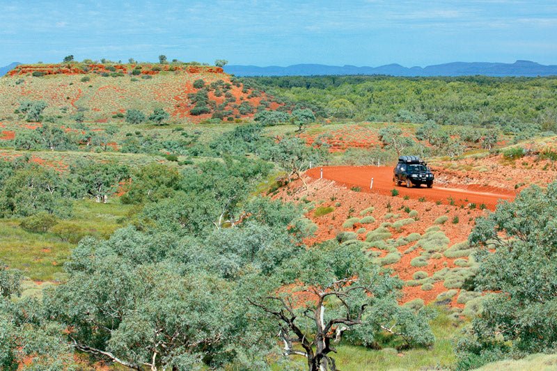
The 17km Snappy Gum scenic drive sweeps through vegetated scrublands featuring white-barked gums, pincushion spinifex and a proliferation of paperbarks along the river bank. A lookout provides spectacular vistas in every direction, particularly the tabletop mesas and the Hamersley Range in the distance.
The Millstream Homstead has 20 designated sites arranged in a circuit, with each tucked into the scrub, but offering little shade. There is a camp kitchen including a gas barbecue, toilets and both hot and cold running water. The homestead was formerly a pastoral station running 55,000 sheep but these days it serves as an unmanned visitor centre with plenty of information on the surrounding area. If needed, the ranger can be contacted using the intercom at the front counter. Camp hosts look after the camps in peak season, collecting fees and distributing information.
From the homestead a walking circuit leads you on a tour of the grounds and into the bushland through scattered date palms, introduced by the early Afghan cameleers. A management plan is slowly removing them so the native Millstream Palm can again flourish. The walk leads to the magical Chinderwarriner Pool - carpeted with lily pads.
The pretty Murlamunyjunha Walk also links the two campgrounds, tracing the path of the Fortescue River. A couple of metal grills provide passage over the river as it narrows, leading to an erosion zone where the landscape shows dramatic damage from earlier floods.
Travel to Carawine Gorge via the bitumen Ripon Hills Road. The way is littered with carcasses, as the speeding road trains are unable to stop for wandering stock along the unfenced plains. Carawine Gorge is located on the Oakover River and accessed via a dirt track around 100km east of Marble Bar. It lies within Warrawagine Station however tourism access is managed by the Department of Environment and Conservation, and the site remains free to visit.
There are plenty of camping options at Carawine Gorge. Taking a right turn and following the wheel tracks at the old fuel drum will take you down to the popular grassed area along the gorge. There are some lovely shaded sites along this section suitable for tents and small camper trailers with views to the gorge and the pretty waterway. Otherwise you can plough on ahead at the fuel drum and find a spot along the gorge.
Heading north past Marble Bar, opt for the back road shortcut to Eighty Mile Beach, along the Muccan Shay Gap Road. The mining interests keep the road wide and in reasonable condition. Keep an eye and an ear open for road trains, as tourists are not expected along this route. Keeping the UHF radio in scan mode will generally warn you of their presence. The drive os quite pretty, running parallel to a mountain range not dissimilar to the Moralana Scenic Drive of the Flinders Ranges as it weaves and dips along its route. The last leg of the journey through Shay Gap and onto Boreline Road traverses a sandy track that for most parts is smooth travelling.
The tide goes out a long way in these parts meaning a long walk to reach the water's edge, but the beaches are beautiful and worth the effort.