The Outback in Flood
|
|
Time to read 2 min
|
|
Time to read 2 min
Outback Queensland has been transformed in recent months and you’d have to be living in a cave disconnected from radio and TV, detached from the internet and cut-off from social media not to have heard about it. The cyclones that ravaged much of the Gulf Country and Cape York earlier this year then sent their life-giving waters down the great ephemeral streams of Outback Queensland – the Georgina, Diamantina, Thomson and Barcoo rivers. The latter two join to form Cooper Creek and some say its the only place in the world where two rivers form to make a creek; such are the idiosyncrasies of our Australian outback.
Flowing south-west these great rivers ooze their way towards a distant Lake Eyre, and in the flat lands of the Channel Country they spread out and form such a vast sheet of water it is almost like an inland sea. The early explorers of Australia, the great Charles Sturt among them, searched for this imaginary sea – they just happened to do so at the wrong time!
As before, during those times of outback floods, towns along the way have been cut off by road for weeks on end. Yet residents of places such as Birdsville and Boulia aren’t really complaining as the country has been wracked by drought for years and water brings life and tourists and money to their areas.
As I write this I’m sitting on a lonely beach north of Broome watching wind-stirred waves wash onto a sweep of white sand ringed by the red cliffs of the Pindan soil that is such a unique image of this area of north-western Australia. The rain that brought the verdancy of life to much of Queensland is pretty much missing, after a wet season that brought little or no rain. And, while we’ll enjoy our little foray here – the first in 30 years where we haven’t been working on a guidebook – we’re planning the next leg of our trip down through Queensland along those green channels that link northern and central Queensland to Lake Eyre.
From the latest reports the amount of water flooding into the vast, normally dry salt pan of Lake Eyre will be enough to see it fill to a level not seen in 45 years. While it wont top the great flood of the 1970s it is still going to be impressive.
The Lake Eyre Yacht Club – yes, it exists – is sure to get a flood of new members. This august body is based in Marree, with its club rooms on the northern outskirts of town. They are planning a few regattas as we write.
Then there are the tough arid land graziers who will soon don fishing hats, unroll their dust-shrouded nets, prepare their long unused boats and grade a road out to a lesser known lake east of Lake Eyre that has seen a fishy harvest each time the Cooper floods. These fishos have to wait for the yellow belly to grow to a certain size before the Department of Environment in SA allows them to haul nets to catch the unexpected desert windfall, but it will surely happen.
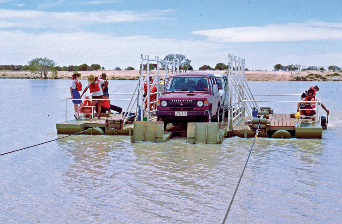
I’m just waiting for the Cooper to flood across the Birdsville Track north of Marree, something I haven’t seen for well over 20 years, when I drove up there just to use and take a few pics of the ferry across the mighty stream. Hopefully I can do it again. Still, there’s many other reasons to wander the backblocks of Queensland and over the years we’ve experienced a few. You can chase dinosaur relics around Winton and Richmond, follow in the wake of Burke and Wills from the NSW/Qld border to the Gulf, or follow the camel and horse races that liven up each and every community that hosts them.
Make sure you head that way soon – seeing the Channel Country in flood is a once in a lifetime opportunity!